

UN Resolution: Sierra Leone Votes in Favour of Map Showing Africa’s True Size
 Sorie Abubakar
 Sierra Leone and other African countries have backed a United Nations resolution calling for maps to more accurately represent the size of Africa and other regions of the world.
The resolution, sponsored by Togo and supported by the African Union, was adopted by the UN General Assembly on Friday by 164 votes to one, with six countries abstaining. The United States was the only country to vote against it.
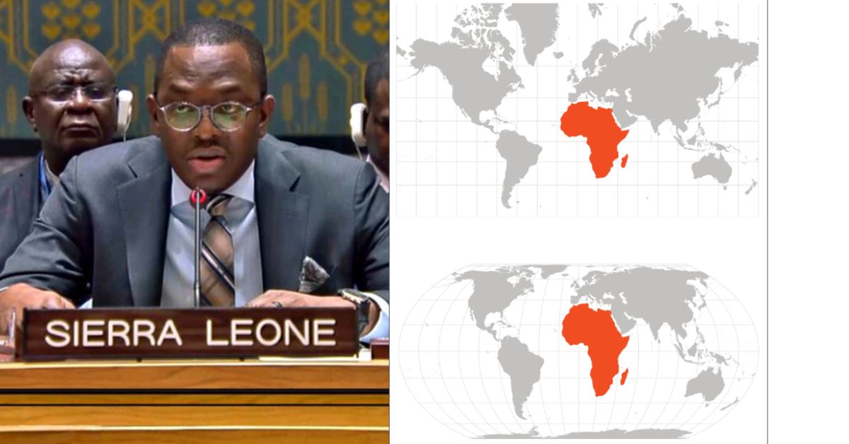
The measure encourages the wider use of equal-area projections such as the 2018 Equal Earth map, which more accurately represents the relative size of continents.

The widely used Mercator projection, developed by Flemish cartographer Gerardus Mercator in 1569, enlarges areas closer to the poles while making regions around the equator appear smaller.
Africa is about 14 times larger than Greenland, although the two appear similar in size on a standard Mercator map.
Togo’s Foreign Minister Robert Dussey, who led the initiative, said: “A fair world begins with a fair map.”
He also said: “Maps shape our understanding of the world. They guide education, nourish the imagination, and influence collective perceptions.”
The United States opposed the resolution. Its representative, Yaryna Ferencevych, said the initiative promoted an ideological agenda and distracted the UN from more pressing issues.
“Resolutions like this and the ideological agenda they promote, are barnacles on our work here, and the reason this institution is losing its credibility,” she said.
The resolution is not legally binding and does not ban the Mercator projection, which remains useful for maritime and aerial navigation.
Togo says it plans to change its school geography materials to the Equal Earth projection by the end of 2026 and encourage other governments, schools and technology companies to follow suit.
Most of these Americans are really ignorant to there fault. They need more education about the rest of the world .