
Serious environmental risks like drought, flooding, coastal erosion, and landslides continue to be a concern for Sierra Leone, and each is made worse by the country’s continuous climate change. Rising sea levels, more intense precipitation, and temperature increases are all predicted effects of Sierra Leone’s changing climate.
Agriculture, fisheries, infrastructure, and the generation of hydroelectric power are all under risk due to the potential of more severe droughts, floods, and storms. The most common natural disasters include coastal flooding, recurring flash flooding, and seasonal flooding in urban and rural areas. The Western Urban district’s Kroo Bay, Susan’s Bay, and Lumley have seen the most of recent tragedies.
Additionally vulnerable are the coastal beaches of the Western Area Peninsula and the districts of Port Loko, Kambia, Western Rural, Pujehun, Bo, Kenema, and Moyamba. Additionally, there is a trans-boundary risk of overflows at the Guinean Great and Little Scarcies River and the Liberian Mano River (World Bank 2017). Floods damage roadways, overload existing infrastructure, taint drinking water, and cause sewage overflows.

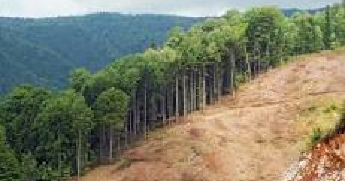
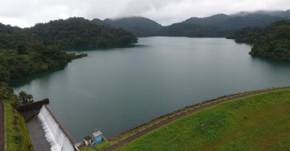
As the catchment area for the Guma Valley reservoir, which provides 90% of Freetown’s drinking water, the Western Area Peninsular Forest Reserve (WAP FORdeforestation )’s poses a major threat to the city. WFP satellite photographs from March 2022 indicated that more than 4,000 hectares of trees had been lost. Even though the reserve is legally protected, unchecked human activity has contributed to the devastation of WAPFOR.
Global Forest Watch reports that 12,696 deforestation alerts were found in Sierra Leone during the course of the previous four weeks, affecting a region of about 155 hectares. 84% of integrated deforestation alerts were located in the top 2 regions. The top 2 regions in Sierra Leone were in charge of 73% of the total decrease of tree cover between 2001 and 2021. In comparison to an average of 455kha, Southern had the greatest decrease in tree cover at 688 kha.
Sierra Leone lost 1.82Mha of relative tree cover between 2001 and 2021, which is a 32% decline from 2000 and 0.42% of the global total. The FAO estimates that in 2010, Sierra Leone’s annual rate of reforestation was 343 hectares (ha). 100% of the increase in tree cover in Sierra Leone between 2000 and 2020 took place outside of plantations. 32.7 kha of Sierra Leone’s humid primary forest were lost between 2002 and 2021, accounting for 1.8% of the country’s overall loss of tree cover during that time.
With proper management, Sierra Leone’s 690,000 hectares of inland valley swamps (IVS) can produce enough agricultural output to ensure the nation’s food security. WFP works with the Ministry of Agriculture to entice small-scale farmers away from the uplands, where deforestation is bad and yields are low, and toward the IVS through its food-assistance-for-assets program and other incentives.
Irrigated IVS offers a high-potential food production system that can be constantly farmed with rice and nutritious vegetables, legumes, and tubers thanks to year-round water availability and fertile soils that don’t need fallow periods. Irrigated IVS offers a more resilient food production system to both adapt to and combat the effects of the climate crisis in light of the rising rainfall variability and deforestation.
140 groups made up of more than 7,500 farmers in seven areas receive assistance from the Ministry and WFP in growing the IVS. The Ministry instructs women and young people, who make up a substantial portion of the farming population, in integrated farming methods for higher yields (typically 2.4 metric tons/hectare). WFP also offers quality fertilizers and seeds.
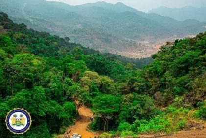
The rising rate of urbanization and the escalating rate of deforestation pose a common hazard to Freetown. The landslide’s location was inside a forestry reserve that was under protection. However, as time went on, some enormous houses were built legally (with permits) and some weren’t (legally). Soil integrity was degraded as a result of building expansion and deforestation, and the capacity to absorb rain during heavy downpours increase the risk of disaster.
It is not necessary to have access to a better water source to know if the supply is constant. For instance, in Freetown, the taps ran empty for the majority of the year in 2009, and this situation persisted until 2022. Wherever possible, people collected water in containers, and those with the means erected water tanks in their homes. Even the fire department sold drinking water out of its vehicles. Fighting occasionally resulted in fatalities between fire fighters and workers for the Guma Water Company, which supplies water to Freetown.
It is abundantly obvious from the evidence that climate change is altering weather patterns and escalating both the frequency and severity of extreme weather events. Sadly, individuals in the most underprivileged communities are disproportionately impacted.


