
As climate change keeps affecting Sierra Leone, more landslides are expected to happen in Freetown according to Kathryn Goodenough and David Boon.
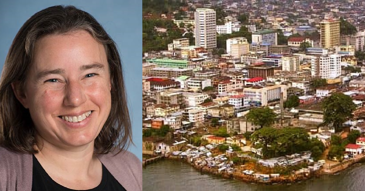
Kathryn Goodenough and David Boon of the British Geological Survey (BGS) are perhaps more intimately familiar with the lay of the land in Freetown than most Freetownians.
Boon, an engineering geologist, had just completed a review of landslide hazard and risk in the Freetown Peninsula for the World Bank-ARUP when the catastrophic mudslides of 14 August 2017 occurred. Goodenough, a principal geologist, flew in a few days later on a planned trip for a UK Aid-funded capacity-building project. The presence in the country of these two experienced geologists (Goodenough and Boon have clocked 20 and 15 years at the BGS, respectively) at this critical time was fortuitous. Their skills in utilising data to assess environmental hazards and providing recommendations for future risk-management were quickly put to use.

“We were asked by the UN team to review satellite imagery to actually map out where landslides had occurred across the Freetown Peninsula, and then, feed that information back onto the people on the ground because they may not have discovered all the landslides that had occurred in the more remote areas,” Boon said. Following this, the scientists were also part of on-the-ground efforts led by the United Nations Office for Project Services (UNOPS) to gauge the stability of the slope and pre-empt future disasters in the area.
On the fourth anniversary of the mudslide, Goodenough and Boon spoke to Tie u Orja’s James Gray and Alejandra Garcia on how landslides develop, the reasons why Freetown is so vulnerable to geological disasters, and the complexity of finding solutions to the brewing environmental hazards in Sierra Leone. The following excerpts from the interview have been edited for brevity and clarity.

On the causes of mudslides
David: The main causes are generally a combination of a steep slope, weak geology, and water. We often think of rocks as kind of hard. But in reality, a lot of the rocks we have under our feet are actually quite soft and weak. You can probably break them up with a spade or a hammer fairly easily, depending on how weathered they are. So, you could have a weak layer of geology or weak material.
Water plays a very important part for causing landslides. Now water generally starts off as rainfall or snowfall. As water falls on the slope, some of it will run over the slope, some will drain into the slope. That water makes the soil heavier. When they’re water saturated, your trousers get heavy. The same is true of a slope. So that increases the stress and the pressure and makes that slope want to break apart and fail.
Then there’s the water pressure in the slope. Essentially, as the groundwater level rises, it fills up all the little holes in the rock and the soil which we call pores. And if that water can’t drain away, it imparts pressure internally on the soil. That pressure in the soil reduces the strength of the slope. It’s almost like when you build a sandcastle and you pour some water on it. It all kind of runs away. So materials can actually change in their strength or their resistance to movement quite rapidly if you do something like change the amount of water in there. These are the kind of things that prepare the slope for failure.
Sometimes the cause can be humans, even someone digging a hole in the wrong place on the slope, or cutting into the slope to build a road or railway.
You also have a trigger. The trigger might be the thing that really sets it off, the straw that broke the camel’s back. Sometimes it can be quite a minor thing like water level in the ground rises, or often it’s a rainstorm like it was in Sierra Leone. In many parts of the world it can be earthquakes, a very sudden shuddering shock that is enough to start the momentum of the slope moving. And that slope is probably close to breaking already, and it’s just the final thing that made it kick off. Sometimes the cause can be humans, even someone digging a hole in the wrong place on the slope, or cutting into the slope to build a road or railway. A river eroding away at the bottom of the slope can also destabilise the soil.
On why the death toll of 2017 mudslide was high
David: The main reason was that people were living directly in the firing line and it was early in the morning, when people were still at home. The landslide was not enormous, but quite large on the scale of things. It was several hundreds of meters wide, and the source area––the area that initially moved––was several hundreds of metres long. Then what happened, we think, was that the soil that got initially moved broke up on the slope. It got mixed with the water that was pounding down the valley, which was bowl-shaped. That added fuel to the fire, in the sense that it created a very mobile flow of soil during a rainstorm. So, if you get a load of soil, pour it down a slope and add more water, it’s going to continue to get wet. And the wetter it gets, the more mobile it becomes. The landslide then went into a channelised river or a gully system and ran out seven kilometres to the sea. And anyone living within that area may have been impacted. The other thing was the vulnerability of the buildings. Anyone living in shacks, those buildings would not resist flood water or a landslide––in fact, hardly any building would be able resist the power of soil because the soil moving in a landslide is incredibly destructive and abrasive, and was full of very large boulders. Some of them were the size of a bus.
The shape of the topography of the hill, slope and the channel also contributed. So within that channel there were several ‘nickpoints’ [places where the slope changes sharply], which turned out to be mini waterfalls. What we think was happening was that the larger boulders that had come down of the main slope were blocking these waterfall channel areas, and the water was backing up behind them. And then occasionally the water broke through and sent a pulse of new sediment. That actually eroded and ripped up more of the channel at the bottom. At this point, the sediment-laden flood had gone from a landslide into almost a flood that was very muddy and full of boulders. And that actually ripped up and eroded more material from the river banks, again adding fuel to the fire, adding more sediment load into that river. And that would have made the volume larger. So, it was almost feeding itself. From what I could see on the ground and from the air, from the satellite images, that’s kind of what transpired.
Kathryn: There have been landslides over the Freetown Peninsula throughout history. The nature of the peninsula, the topography, the geology means that there will always be landslides. The difference with this one was that there were a lot more people in the path of the landslide. Freetown is a growing city and people are moving to live in areas that weren’t traditionally inhabited. So you have, like Dave says, a really powerful landslide with an awful lot of large boulders as well as this sort of mixture of mud and water––and there are just a lot more people living in the path of that landslide and the flood than there would have been, say, 50 years ago.
On deforestation, urban planning, and landslides
Kathryn: On that day, there were several landslides across the Freetown Peninsula and some of them were in forested areas. Including up at the Tacugama Chimpanzee Sanctuary. As I said, landslides have occurred around Freetown Peninsula in the past too, when it was all covered in forest. So you have to be a little bit careful about saying that deforestation is the cause. It perhaps means that there is less natural protection, but it’s not necessarily a cause because landslides happen in the forested parts too. And also on the discussion of poor urban planning, I think it is important to remember Freetown topographically is very steep. It has quite particular geologies that we know have specific plains of weakness in them, but there’s not some kind of amazing map of all of these issues in Freetown. There’s not the most immaculate geological map that would tell you exactly where the problem areas are because that is the kind of thing that is very expensive to achieve, and very few countries would actually have all that kind of information available. So I think you can’t necessarily say that it’s poor urban planning, and that’s that—because it’s not necessarily the case that the information is all there to inform the urban planners. So there is undoubtedly a need for more sound data. Is that fair Dave?
David: Yeah, I think studying the deposits and the landscapes around Freetown, we do see evidence that landslides were occurring in areas that had virgin rainforest on them. So it doesn’t mean that landslides can’t occur on forested slopes, but I would say that they’re more likely to occur on deforested slopes because of the reasons I mentioned about water percolating more quickly. Having forest there reduces the amount of water that gets through. It’s a buffer, so it slows down the transport of water from the sky to the ground, and if you can slow that down, it would reduce the triggering effect. So there’s a message there around being careful about deforestation. It may not be the sole cause, it’s a natural phenomenon that is happening any way.
The actual danger of the landslides is probably about the same as it was 50 years ago. But the exposure is higher because people are living in the way now.
The problem is that people more and more are building up onto those slopes and living within those catchments, whereas they didn’t do that before so much. The actual danger of the landslides themselves, what we call the hazard, is probably about the same as it was 50 years ago. But the exposure is higher because people are living in the way now. So there may be better places to build and live and worse places––but there isn’t really a zoning map that can perhaps aid the council. There has been work done in a more generic sense. Sierra Leone recognises landslides are problematic, but there’s no kind of clear guidance for land-use planning. And all this needs to be backed up by funding of agencies that can essentially review and police where people are building, the quality of the buildings etc. The resource needs to be there to enable effective land-use planning.
Kathryn: It’s a complex system of understanding where the hazards are––which is something that isn’t fully mapped in Freetown. And it’s being able to do the planning better and then it’s being able to ensure that people can actually live in the areas that are considered to be a lower risk. You have to have some support for those people to ensure that they can afford to live in those areas. So it is complicated. There is no way around that.
On the risks faced by Freetown communities
David: I think it’s certain that more landslides will happen again. The slope that failed, you know, that slope is still potentially unstable. It’s likely that a landslide may not happen in exactly the same place, but the worry is that it might happen just to the side of that, where the landslides created a new cliff face, almost in the slope, and that new cliff face will be unstable because it’s a free face. There’s actually no way of knowing when and where the next landslide will occur. People constructing buildings on slopes need to be educated not to do anything that might destabilise the slopes above and below, such as cutting deeply into the side without some geotechnical advice, or changing drainage provision. That is around education and around having building codes to try and minimise the likelihood of setting off landslides.
Kathryn: There is a hazard in many parts of Freetown, but we don’t know exactly where that hazard is the highest. Obviously where people are living on the hillsides in and around Freetown, then they are potentially exposing themselves to the landslide hazard. Exposure and hazard together give you risks.
David: There was a report we did with ARUP for the World Bank. It does have a risk assessment and hazard and risk maps in it, and this is a good starting place for planners to understanding the worst areas for natural hazards in Freetown. But, of course these maps are the best you can do with not very much data. The geological data across peninsula is quite old and not accurate. So, you know, you can do lots of calculations, but what you produce will really be quite speculative at the end of the day. What we are seeing is a trend. Whatever the hazard is today, it’s probably worse tomorrow, because we have these compounded effects of increased population and climate change brining more intense rainstorms. This is bad news because those intense rainstorms tend to be the ones that trigger landslides.
On risk-reduction
David: Learning from the slides that already occurred in 2017 and 1945 you could develop a forecasting and early-warning system, where we say, so much rain has fallen in certain periods, so today there is a green, amber, red alert for landslides. But that should be underpinned by as good as possible meteorological, geological, and topographical data bound together in computer models. All that stuff, you know, costs money. There have been conversations about moving towards something like that in future. Even then, the risk will never be zero, and people will have to live with a certain level of risk––the best approach is to work with nature, and avoid living and building critical assets in the potential path(s) of destructive landslides.
Kathryn: We’re not talking about things that can be easily done, in the short time, with relatively small amounts of money. We are talking about long-term research that would need capacity that doesn’t exist in Sierra Leone at the moment. They will need to really understand what the situation is, to try and get an idea on which areas might have the highest landslide hazard. So there’s no quick fix. The Freetown Peninsula is challenging topographically and geologically, and you’ve now got something like two million people living there and more people moving in all the time. To give you an example, in Hong Kong they were facing the same combination of challenging topography, geology and weather condition. Over decades Hong Kong spent huge amounts of money on engineering and on the type of planning constraints and construction guidelines that David has been talking about. They really spent money on understanding their geology. So, yes, you’d be looking at decades-long programme for Freetown to try and archive something similar.
David: There needs to be an integrated land-use policy and management, and education schemes right across the society. And the funding needed to ultimately make it happen. In Hong Kong, we pretty much covered the slopes in concrete and rock anchors and things. At the moment in Sierra Leone the economics wouldn’t stack up. People can’t afford expensive housing.
But improvements in digital data management and data sharing between departments could happen more freely using GIS (geographic information systems). So all those departments need money and funding support to kind of work together on those shared issues, including the management of the protected forest areas.
It needs political will. Not only in Sierra Leone, but we need global partnerships to really be able to make a difference in this sort of situation. This is not something that Sierra Leone can do on its own.
On the need for long-term planning and global partnerships
Kathryn: I think the key message we’re trying to get across is that in Freetown there will always be landslides. But understanding their interaction with people and how people are based at risk is very complicated. The more data you can acquire, whether that is the geological, topographical, related to weather, forest cover, where people are living, how their buildings are built—all that kind of information is really important. In Freetown, a lot of that data is not available. So it’s really important to appreciate that there is long-term problem here. It can’t be fixed quickly, and it can’t be fixed easily.
David: It needs political will over a long period. It needs institutional structures and funding and systems and expertise, and the capacity to run and maintain [all these systems].
Kathryn: As David says, it needs political will. Not only in Sierra Leone, but we need global partnerships to really be able to make a difference in this sort of situation. This is not something that Sierra Leone can do on its own.


